Low traffic neighbourhoods in Headington – evolution not revolution!
Contrary to what we've heard on the news over the past year, there's nothing new about LTNs, especially in Headington

We know not everyone shares our enthusiasm for LTNs. People are often suspicious of what they see as ‘new’ or ‘radical’ ideas, particularly when those ideas challenge the current status quo of car dominance and priority on our roads that we have become conditioned to see as the norm.
However, LTNs are neither new nor radical, and have been best practice in urban residential design for centuries – even going as far back as the Romans! (See Forbes’ article, U.K.’s ‘Low Traffic Neighborhoods’ Nothing New: Ancient Romans Blocked City Roads To Carriages)
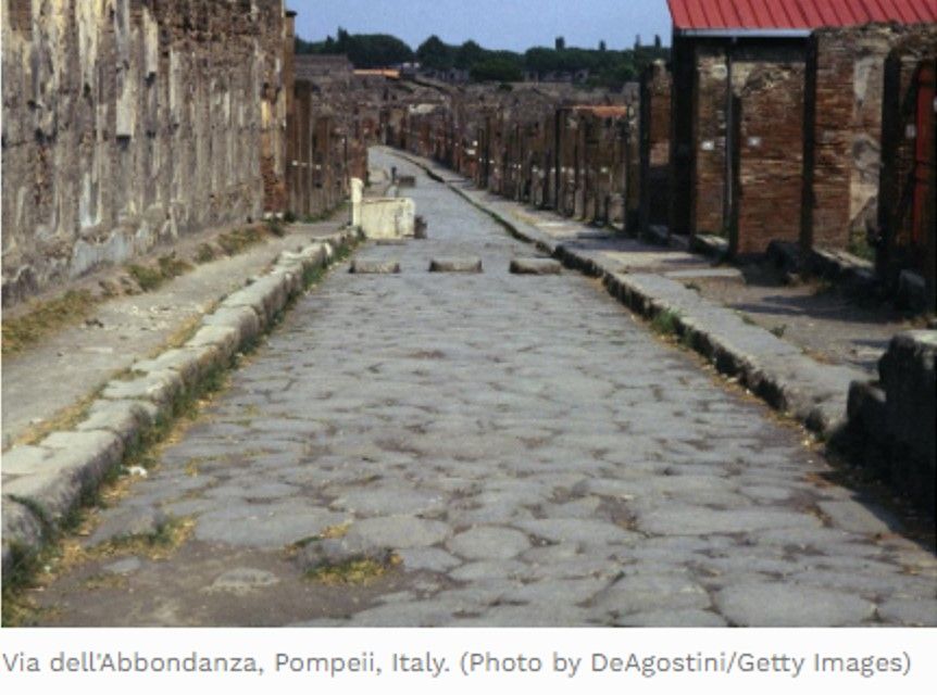
Ancient Rome wasn’t the only place to install LTNs, though, as these wonderful but now rather dated archive films of 1970s Exeter and 1980s London show...

The discourse surrounding Low Traffic Neighbourhoods is quite strange given they've been a feature of street design for decades. Here's an archive film (c. 1980s) from the London Metropolitan Archives, showing how modal filters work. pic.twitter.com/6dfibur5Yc
— Adam Tranter (@adamtranter) February 20, 2021
This post looks at how LTNs really are nothing new in Headington. Many Headington residents already benefit from living in LTNs. Some of these were purpose-built as LTNs and some have been ‘retro-fitted’ with filters to prevent problematic through-traffic. People barely notice them, and no-one who lives in these LTNs is asking for the filters to be removed so that their neighbourhoods can become high-traffic neighbourhoods, even though that might provide residents with more direct access by car to surrounding main roads.
Read on to see if you recognise any of these ‘modal filters’ from your everyday journeys around Headington. What about your road? Do you already live in a low traffic area?
Areas in or near Headington designed on the LTN principle
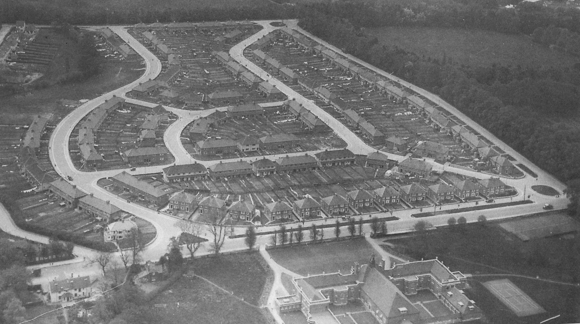
First, we’ll look at the purpose-built LTNs – mainly post-war housing developments, with low-traffic infrastructure designed-in from the start in recognition of the many benefits LTNs provide for residents and others…
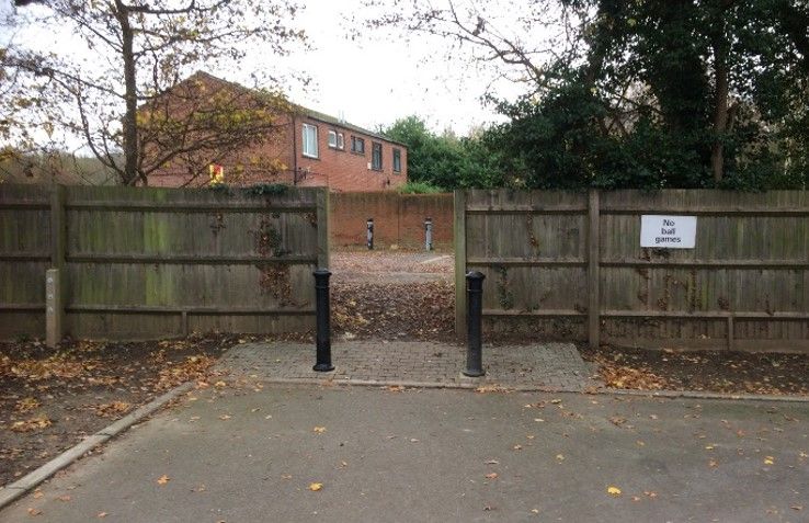
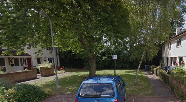
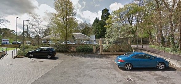
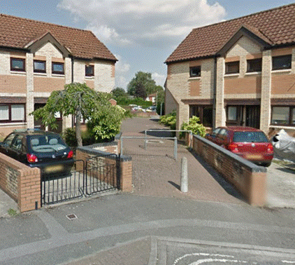
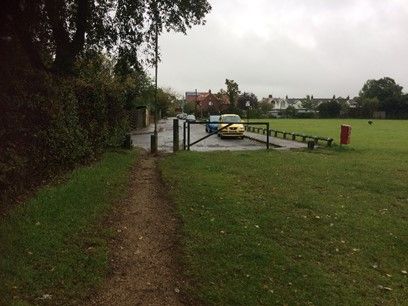
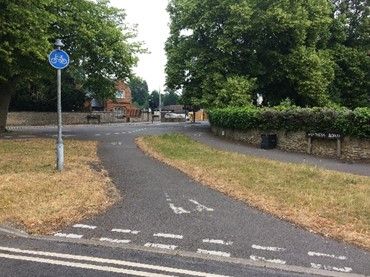
East Field Close/Hundred Acres Close
These housing developments could have been built in a way that allowed drivers to cut through from Horspath Driftway to Hollow Way to avoid the junction at Horspath Road/Hollow Way/The Slade. Instead, just three bollards ensured low traffic neighbourhoods for residents of both neighbourhoods whilst allowing pedestrian and cycling access through the estates (see the green circle on the map below).

Here’s what they look like on the ground:
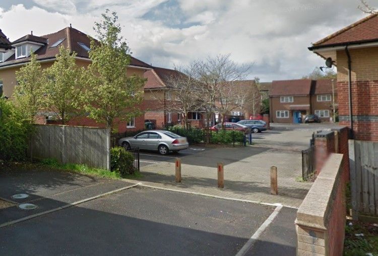
Have a look at the Google Street View here: Hundred Acres Close.
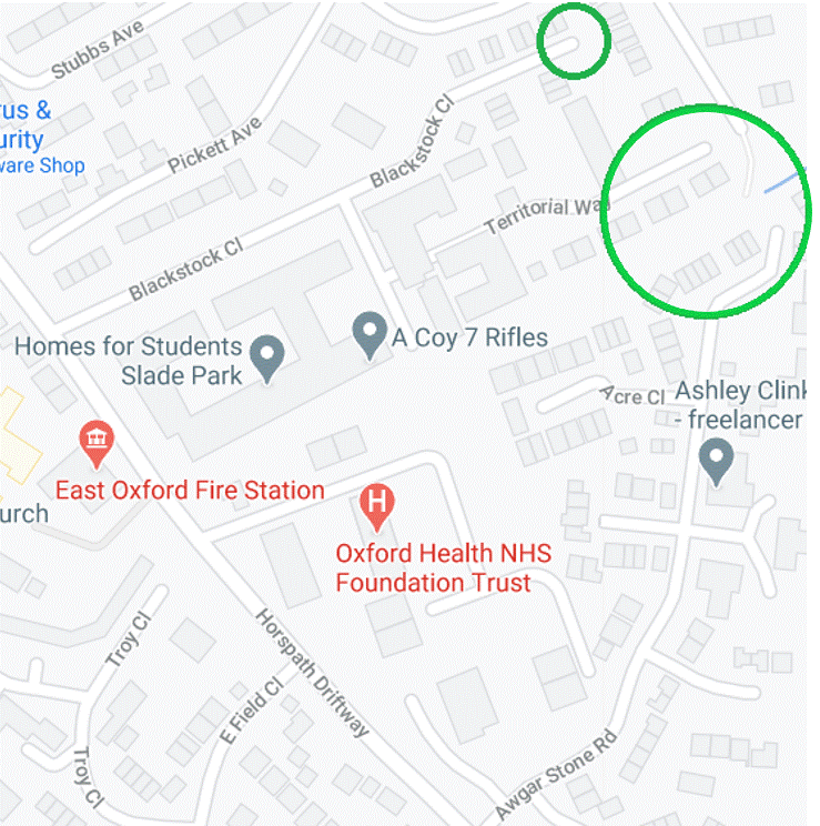
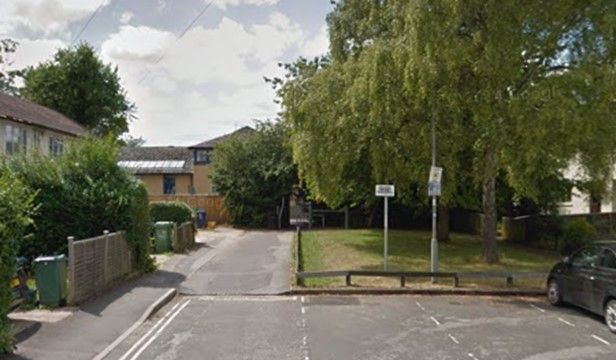
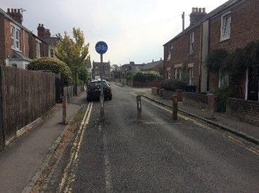
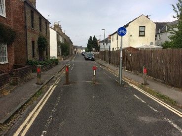
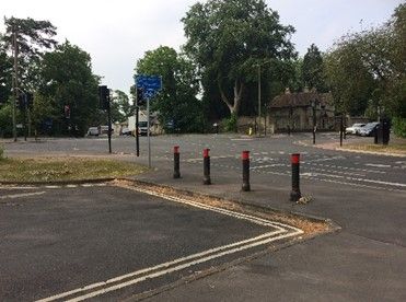
Awgar Stone Road, Blackstock Close and Territorial Lane
These developments could have been built in a way that allowed drivers to cut through from Horspath Driftway to Wood Farm. They could even have had direct car access to the Eastern Bypass. Instead, various types of filters have been used to create low traffic neighbourhoods for residents of these roads (see the green circles on the map below), and the planners chose to prioritise quiet, safe roads over convenient access to the Eastern Bypass. Access to the Eastern Bypass would have ensured these roads were high-traffic neighbourhoods providing access to the Ring Road, much like Headington Quarry is at the moment.
Here’s what they look like on the ground:
Google Street Views: Territorial Way, Long Close, Awgar Stone Rd.
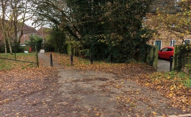
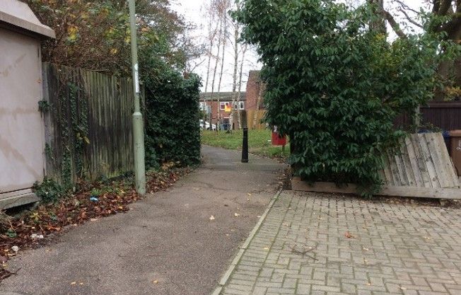
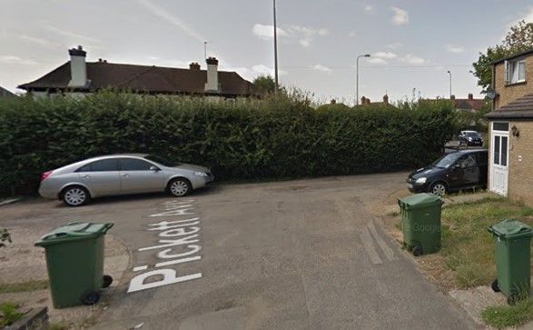
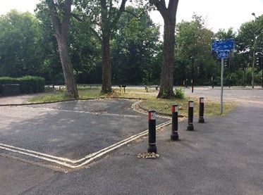
Stubbs Avenue
This could have been built to allow drivers to cut through to Leiden Road, but instead a paved area at the end of Stubbs Avenue prevents this (see green circle and view from the ground below).
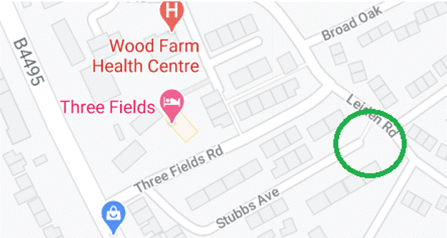
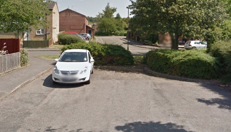
Google Street View: Stubbs Avenue.
However, Three Fields Road has no filters and can be used by drivers to cut through from The Slade to Leiden Road and the Wood Farm road network.
Broad Oak/Long Close/Abbots Wood/Pickett Avenue
These developments could also have been built in a way that allowed drivers to cut through from Horspath Driftway to Wood Farm and have direct car access to the Eastern Bypass. Instead, various types of filters have been used to create low traffic neighbourhoods here (see the green circles on the map below), with no direct car access to the Eastern Bypass.
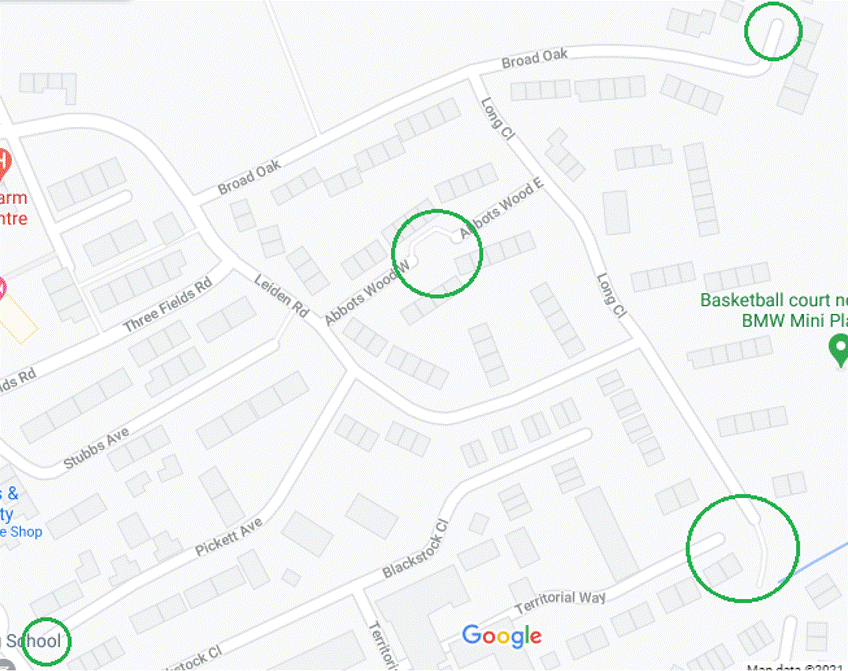
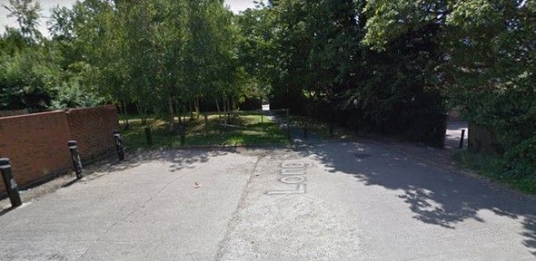
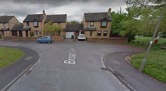
Google Street Views: Pickett Avenue, Long Close, Broad Oak.
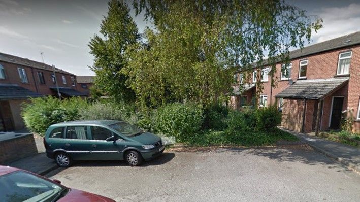
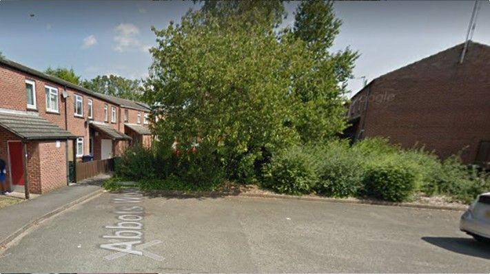
Google Street Views: Abbots Wood East, Abbots Wood West.
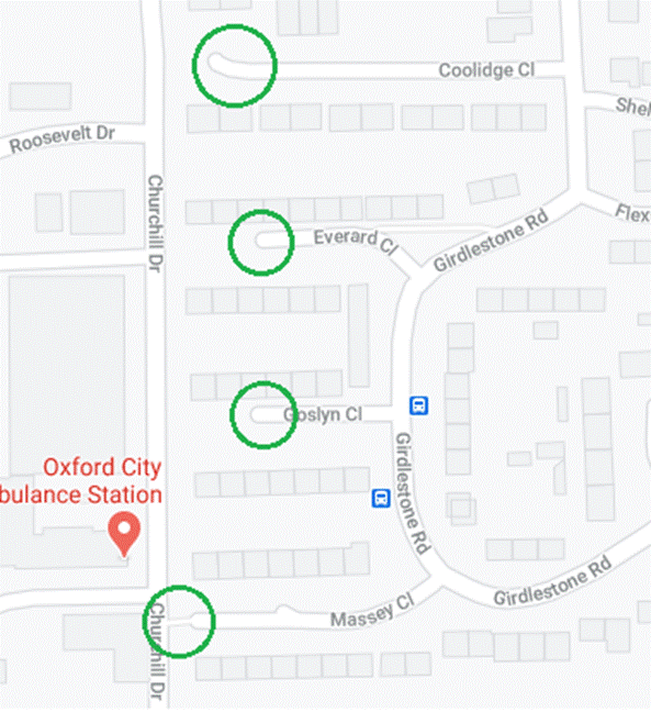
Coolidge Close/Everard Close/Goslyn Close/Massey Close
These could have been built to allow car access onto Churchill Drive, which would have ensured these roads were high-traffic cut-throughs for Churchill Hospital visitors and staff from the Slade via Girdlestone Road. Instead, they are shielded from Churchill Drive with lawn areas, bushes and trees (see green circles on the map below).
Here’s what the filters look like on the ground:
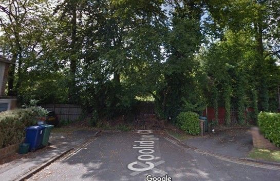

Google Street Views: Coolidge Close, Everard Close, Goslyn Close, Massey Close.
Unfortunately, residents of Girdlestone Road bear the full brunt of through-traffic between The Slade and Old Road avoiding the Old Road/The Slade/Windmill Road junction. There are measures which could be used to deal with this, the most obvious being an APNR-controlled bus gate (which could have resident/blue badge exemptions), which residents could raise with their local Oxfordshire County Councillor if this is something they wanted to pursue.
Little Oxford (Demesne Furze, Mileway Gardens, Skene Close, Acland Close)
This estate could have had direct car access to Old Road, rather than having only one car-accessible entrance via Roosevelt Drive, but that would have resulted in 1000s of people driving through these roads from Old Road to avoid the Old Road/Gipsy Lane/Roosevelt Drive/Warneford Lane junction. It could also have allowed through-traffic along Mileway Gardens and Demesne Furze, which would probably have led to 100s of people trying to ‘nip round’ to avoid the queues that form on Roosevelt Drive. Instead, it is a low traffic neighbourhood with handy cut-throughs for pedestrians and cyclists who need to get to the Churchill Hospital thanks to three filters (see green circles on the map below).
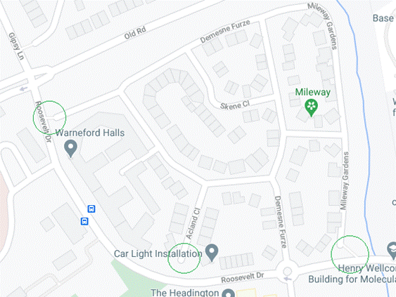
Here’s what this looks like on the ground:
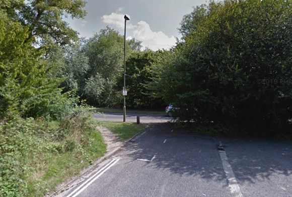

Google Street Views: Mileway Gardens, Demesne Furze, Acland Close.
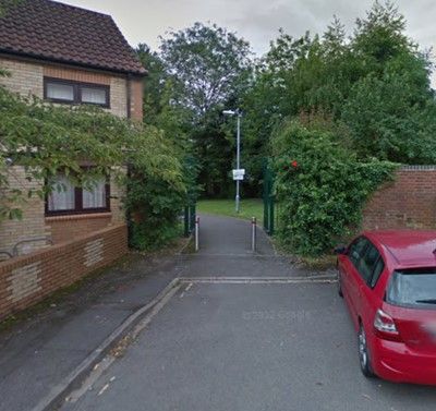
Cheney Lane
This could have allowed through-traffic from Warneford Lane to Headington Hill. Instead, this is a low traffic neighbourhood thanks to the barrier at the junction with Headington Hill (see green circle on the map below).
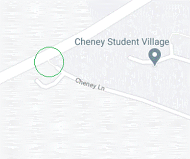
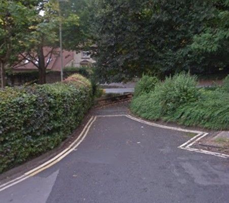
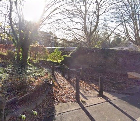
Google Street View: Cheney Lane.
Mattock Close
This could have been built to allow car access to Gardiner Street and the network of roads off Bateman Street, and from Gardiner Street to the Nuffield Orthopaedic Centre – making Mattock Close a high-traffic neighbourhood from the start and turning the older Bateman Street network of roads from a low-traffic neighbourhood into a high-traffic neighbourhood, as people would inevitably have cut through those new routes to avoid the junctions at either end of Windmill Road. Instead, Mattock Close was built as an LTN and the older roads stayed as an LTN, thanks to the filters at the end of Gardiner Street (see green circles in map below).
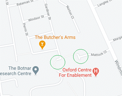
Google Street View: Gardiner Street.
The Willows
A recent addition to Barton Road, a prime example of how modern housing estates are built on the LTN principle:
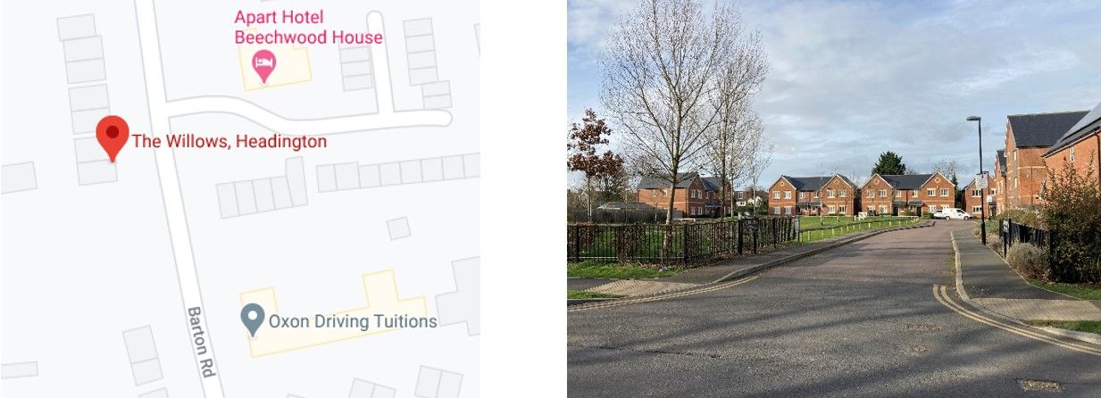
View from Barton Road – Google Street View: The Willows.
Sandhills
This housing development design is based on LTN principles, with only one car access point off the A40. It could have been built to allow direct car access between Sandhills and Barton, allowing people to drive via that link to avoid Green Road Roundabout, but instead there are only pedestrian and cycling paths linking the two neighbourhoods. The green circles on the map below show the main design features that make Sandhills an LTN.
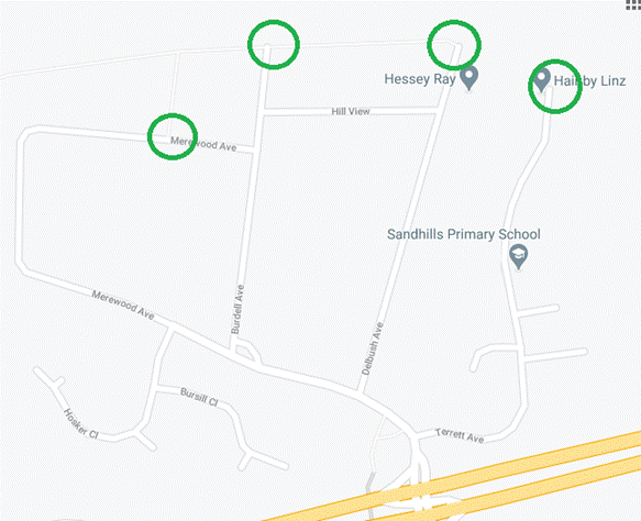
Here’s what the filters look like on the ground:
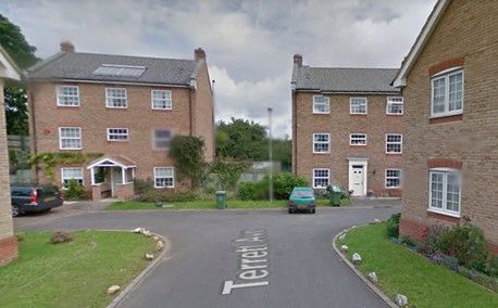
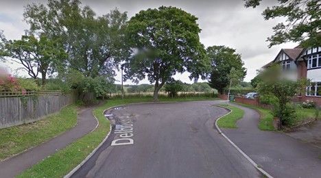
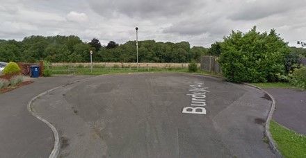
Google Street View: Terrett Avenue, Delbush Avenue, Burdell Avenue.
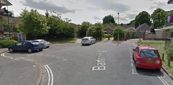
Barton
With the exception of Bayswater Road, which forms the main route out to the villages north-east of Headington, all the roads in Barton were designed on the LTN principle – the roads in Barton are only used to access addresses in Barton, with no car access to the A40 or Sandhills from the Barton roads.
However, the new development of Barton Park includes car access between Barton and Barton Park via Barton Village Road, so it’s possible that residents on the north-west side of Bayswater Road will experience higher traffic volumes on their roads – from Barton Park residents who would prefer to access the Ring Road at Green Road Roundabout rather than the purpose-built new accesses on the A40 North Way and/or people trying to avoid congestion along the A40 North Way on the approach to Green Road Roundabout.
Many Headington residents already benefit from living in LTNs... People barely notice them, and no-one who lives in these LTNs is asking for the filters to be removed so that their neighbourhoods can become high-traffic neighbourhoods.
Now for some older roads that have been retro-fitted to become LTNs…
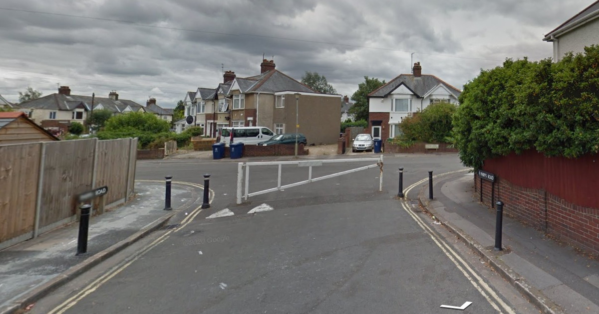
Staunton Road
Staunton Road and Sandfield Road were used as a cut-through from Headley Way to London Road to avoid the Headley Way/London Road/Headington Road junction before a filter was installed (see green circle on map below). Unfortunately, it is still possible for drivers to use Woodlands Road and Sandfield Road (south end) to cut through the south-east side of this neighbourhood between Headley Way and London Road to avoid the Headley Way/London Road junction.
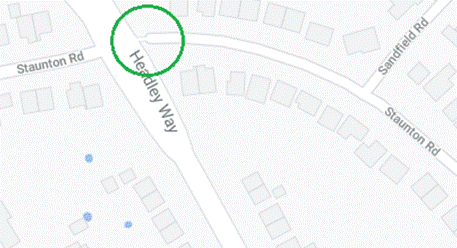
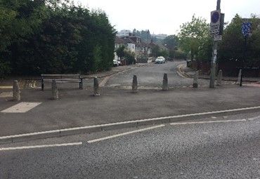
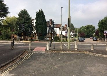
Google Street View: Staunton Road.
Bateman Street
Bateman Street and adjoining roads were used as a cut-through between Windmill Road and London Road until a filter was installed in the early 1980s (see green circle on the map below), together with a 1-way system on Kennett Road and New High Street – mainly to deal with HGVs using the cut-through to deliver to businesses on London Road.
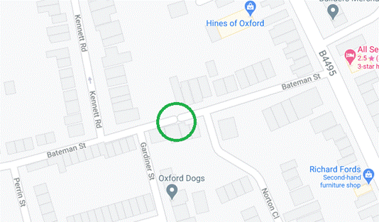
Google Street View: Bateman Street.
Northfield Road
Instead of allowing a through-route from London Road to Barton Road, a filter ensures that Northfield Road is a mini-low traffic neighbourhood and also creates a safer play area for children in the park with very few cars driving past the north side of it.
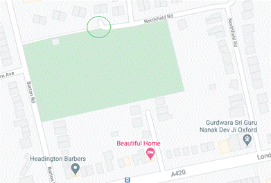
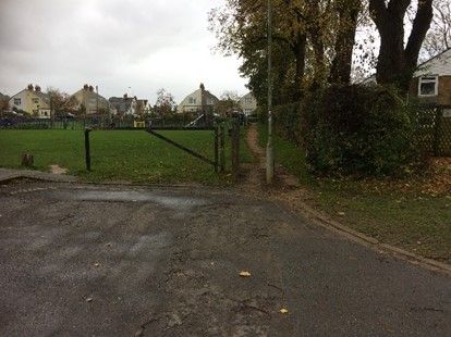
Google Street View: Northfield Road.
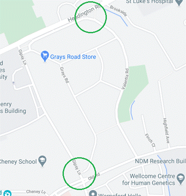
Gipsy Lane Estate (2/3 of the way towards being an LTN…)
This estate was initially built wide-open to car access from all sides, in an era when most people didn’t have cars.
Since then, it has had two of its four entrances closed to cars by the addition of filters on Headington Road/Valentia Road and Grays Road (see green circles on the map below). Just one more filter would turn Gipsy Lane Estate into a low traffic neighbourhood, removing traffic cutting through between Old Road and Gipsy Lane to avoid the Old Road/Gipsy Lane/Warneford Lane junction.
Here’s what the filters look like on the ground:
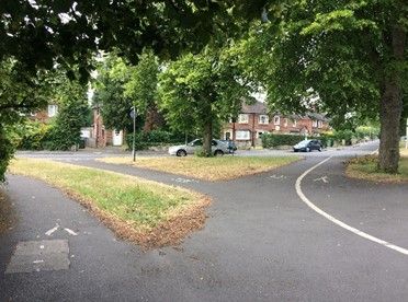
Google Street Views: Valentia Road, Grays Road.
Ingle Close
This could have been built to allow car access between Saxon Way and Dunstan Road. Instead, a filter was put in to prevent this (see green circle on the map below), creating a low traffic neighbourhood for residents of Ingle Close.
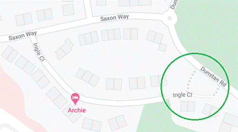
Google Street View: Ingle Close.
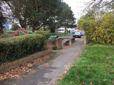
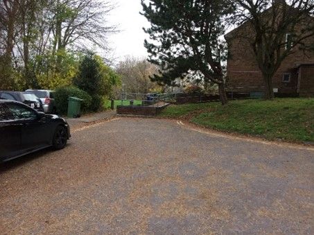
North Way/Barton Road/London Road ‘triangle’
All the roads in this area are LTNs, produced by a mix of the old and the new – some built as cul-de-sacs and some retro-fitted with filters (see green circles in map below).
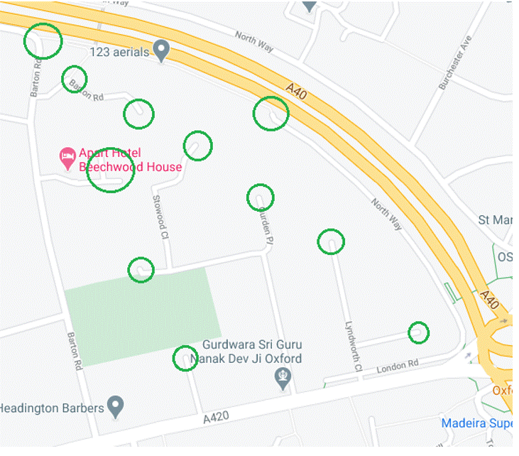
Here’s what the filters look like on the ground:
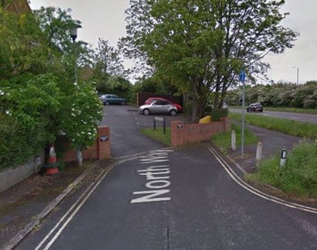
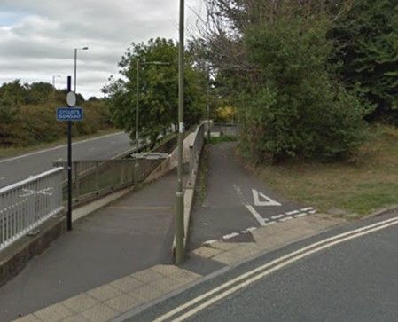

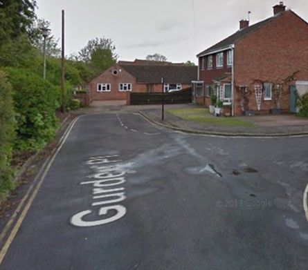
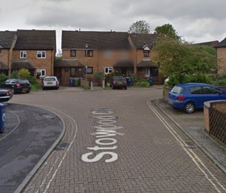
Google Street Views: North Way, Barton Lane, Lyndworth Close, Gurden Place, Stowood Close, Barton Road.
And there are many more...
There are many other roads in Headington that could be described as ‘mini-LTNs’, such as:
Finch Close and Highfield Avenue (off Old Road)
Wilberforce Street/Perrin Street/Gardiner Street/Windsor Street
Binswood Ave/Larkfields
Norton Close (off Bateman Street)
Barrington Close (off All Saints Road)
Burrows Close (off Wharton Road)
Ramsay Rd (south end)
The Croft (off Old High Street)
Laurel Farm Close (off St Andrews Road)
St Andrews Lane and Larkins Lane (off St Andrews Road)
Ivy Lane (off Osler Road)
Stoke Place (off St Andrews Road)
Ethelred Court (off Dunstan Road)
North Place (off Old High Street by Bury Knowle Park)
Stephen Road (off London Road)
Langley Close (off Windmill Road)
Brookside Close (off London Road/Headington Road junction)
Latimer Grange and The Brambles (off Latimer Road)
Blackburn Close (off London Road, behind the Manor Hospital)
Horwood Close (off London Road)
Beech Road (off Sandfield Road)
Woodlands Close (off Woodlands Road)
Blackthorn Close and The Beeches (off Barton Road)
What about the high traffic neighbourhoods?
Hopefully, this post illustrates that the concept of low traffic neighbourhoods is not new or radical, either in Headington or Oxford more generally. Many Headington residents living in newer housing developments or areas that have been retro-fitted with filters already benefit from low-traffic environments outside their front doors. It is basically only the older residential areas, built before private car ownership was endemic, that remain as high-traffic neighbourhoods:
Headington Quarry
Rock Edge (the network of roads bordered by Quarry Road/Old Road/Windmill Road/Margaret Road)
Wharton Road area (the network of roads bordered by London Road/Ramsay Road/Wharton Road/Margaret Road/Windmill Road)
Old Headington
Highfield
Gipsy Lane Estate
Woodlands Road/Sandfield Road (south)
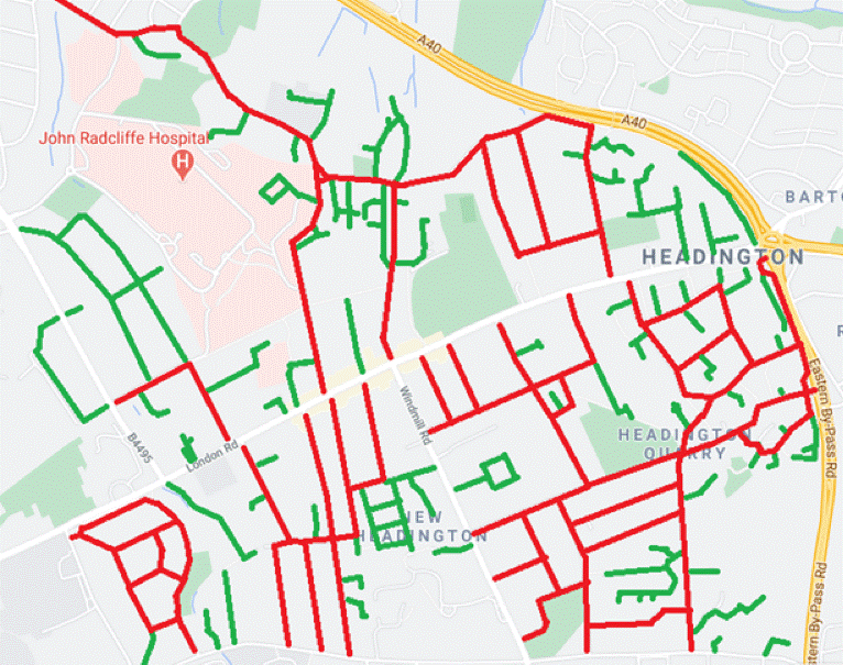
The map below illustrates the LTN/HTN distribution on minor residential roads in Headington (green = low-traffic roads; red = high-traffic roads):
There are also many other examples of existing LTNs across Oxford – this blog by Danny Yee highlights some of them:
Do let us know if we’ve missed any Headington LTNs, and we’d love to receive your photos and testimonials about filters in Headington that particularly benefit you, either as a resident or someone who travels through them using active travel methods (walking, wheeling or cycling).
See our other posts What is an LTN?, I live in one of the proposed LTN zones... and Who benefits from LTNs? for further information about LTNs and their benefits.