Re-imagining Headington’s roads and junctions – Headley Way junction

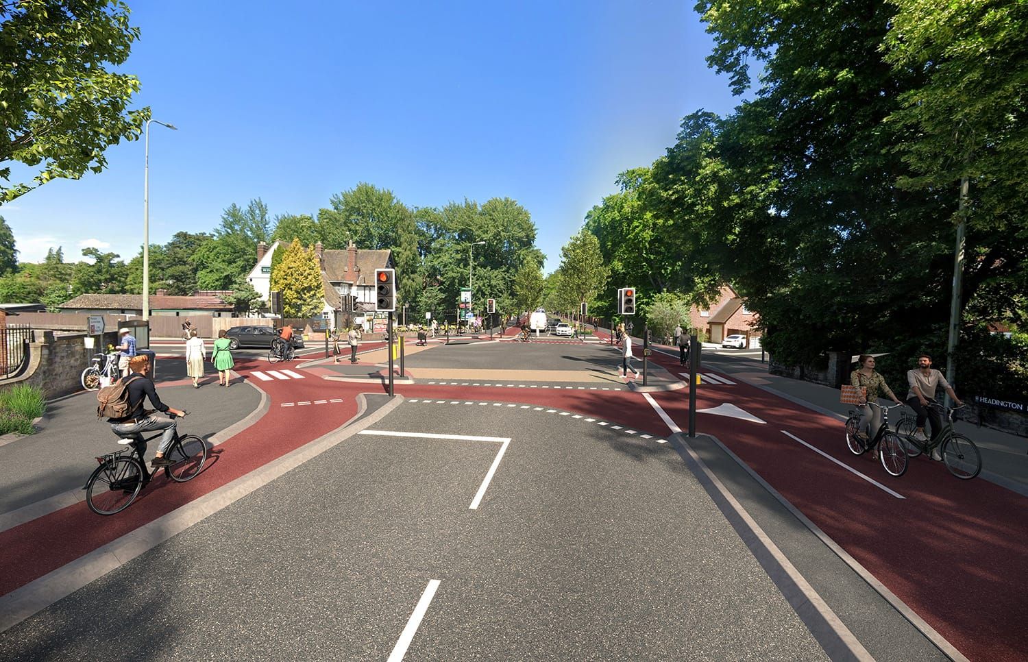
Further to the visualisations HLS previously commissioned for the Headington centre junction and WOGR junction outside Cheney School, we have now obtained one for the Headley Way junction.
This visualisation is based on a Cyclops design produced by City Infinity, funded by Oxfordshire Liveable Streets.
The 3D visualisations are produced by InfraCGI, funded by Foundation for Integrated Transport (see our project page).
“Cyclops” stands for Cycle Optimised Protected Signals. The Cyclops junction design completely separates pedestrians and cyclists from motor traffic, reducing the possibility of collisions or conflict. Pedestrians are also able to cross in fewer stages with more space to wait than with other junction designs. See this paper from the Greater Manchester Bee Network about Cyclops junctions for more detail.
We decided to focus on this junction next because this was the site of a fatality: Jennifer Wong was killed here in September 2021 as she cycled across the Headley Way entrance from Headington Road to London Road and was hit by a crane lorry turning left into Headley Way. The junction also has particularly negative impacts on some of the most vulnerable road users - children - as it forms an unavoidable part of the route to school for hundreds of school pupils who attend Cheney School, Headington Rye School, St Joseph's Primary School and Windmill Primary School.
The junction remains very dangerous and difficult for cyclists to use, causes delay and inconvenience for people walking and wheeling, and puts cyclists and pavement users into conflict. The small changes made to this junction in response to Jenny’s death as part of Oxfordshire County Council’s Vision Zero work (adding an advance green light for cyclists heading East and removing the stone planter/adding a dropped kerb to enable cyclists to use the pavement to turn left onto Headley Way) have done little to improve the safety of people cycling through it, nor improved the situation for pedestrians. (See this opinion piece in West England Bylines for more detail.)
As with the Dutch roundabout designs for the WGOR junction and Headington Centre junction, space is made for protected cycle lanes and pedestrian crossings by re-allocating carriageway space, reducing 2-lane entries to 1-lane entries. (Currently there are two lanes for approaching motor traffic on London Road, Headley Way and Headington Road.)
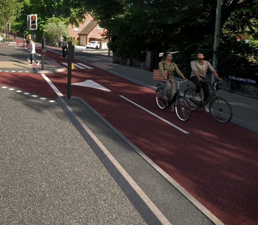
This design also effectively incorporates the cycling route from Valentia Road/Headington Road service road onto Headley Way and London Road. This is currently a problematic movement for cyclists, with no clear and safe way to enter the junction when approaching from that corner. That is why there is a small stretch of 2-way cycling provision and an angled crossing which can be seen at the right of the visualisation:
A feature we particularly like about this design is the addition of lots of trees and rainwater gardens in the buffer between the cycle lanes and carriageway on London Road, which you can see if you zoom into the visualisation:
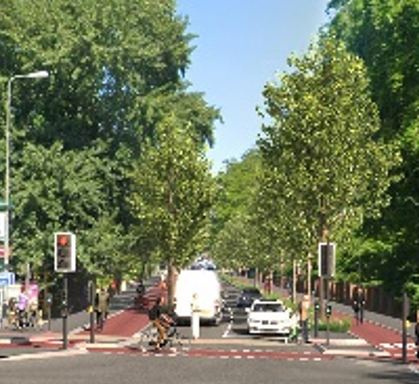
These features are welcome for so many reasons and benefit all road users: for example trees provide shade, reduce air and surface temperature significantly and help improve people’s health e.g. by boosting immunity and reducing stress, and the gardens help alleviate flooding, filter pollutants and cool the air.
Rebuilding main road junctions like this is in line with, and required by, Oxfordshire County Council’s Local Transport and Connectivity Plan. Such infrastructure changes are needed to implement various LTCP policies, including:
- Policy 1 – Transport User Hierarchy: develop, assess and prioritise transport schemes, development proposals and policies according to the following transport user hierarchy:
- Walking and wheeling (including running, mobility aids, wheelchairs and mobility scooters)
- Cycling and riding (bicycles, non-standard cycles, e-bikes, cargo bikes, e-scooters and horse riding)
- Public transport (bus, scheduled coach, rail and taxis)
- Motorcycles
- Shared vehicles (car clubs and carpooling)
- Other motorised modes (cars, vans and lorries)
- Policy 2 – Walking and cycling networks: Develop comprehensive walking and cycling networks that are inclusive and attractive to the preferences and abilities of all residents in all towns, working closely with stakeholders using co-production methods when developing and improving cycle and walking networks from inception to delivery.
- Policy 4 – Strategic Active Travel Network: identify key routes for walking and cycling and prioritise interventions to existing and new infrastructure.
- Policy 8 – Healthy Streets Approach: Improve the human experience of streets and encourage walking and cycling.
- Policy 15 – Vision Zero: Seek to eliminate all fatalities and severe injuries on Oxfordshire’s roads and streets, to have safer, healthier, and more equitable mobility for all.
However, such junction rebuilds are only possible with a reduction in motor traffic from current levels. This is because by reducing junction entries from 2-lanes to 1-lane, motor traffic throughput is reduced – i.e. fewer motor vehicles can get through in any given amount of time. Oxfordshire County Council is trying to achieve traffic reduction through the Congestion Charge (to be replaced with the Traffic Filters in September), the Zero Emission Zone in the City Centre and the planned Workplace Parking Levy.
Unfortunately, Oxford City Council’s recent decision to approve a 52% increase in car parking spaces as part of the Warneford Park development is likely to make such junction redesigns impossible, as the additional car trips that will be generated by that car parking will increase motor traffic on Headington’s roads rather than decreasing it. The developer’s own Transport Assessment predicts that 69.7% of Warneford Park staff will route via Headley Way or London Road, yet it did not assess the impact of the additional car trips on this junction.
There are two particular safety impacts that Oxfordshire County Council’s highways assessment of the development completely failed to address: that the additional car trips generated by the development will: (i) increase danger to cyclists, pedestrians and wheelers at this junction and all other main road junctions in Headington; and (ii) prevent implementation of the infrastructure changes that are necessary to ensure the safety of cyclists, pedestrians and wheelers. The safety impacts on this junction are particularly concerning given the previous fatality here and the fact that it is an unavoidable obstacle on hundreds of school pupils' routes to school.
However, we now at least have a workable re-design for this junction that we will push when any funding opportunities become available. And we hope that the visualisation will help Headington residents and road users see what is possible here and how their journeys could be made safer, easier and more pleasant.